What is a Fire Insurance Map?
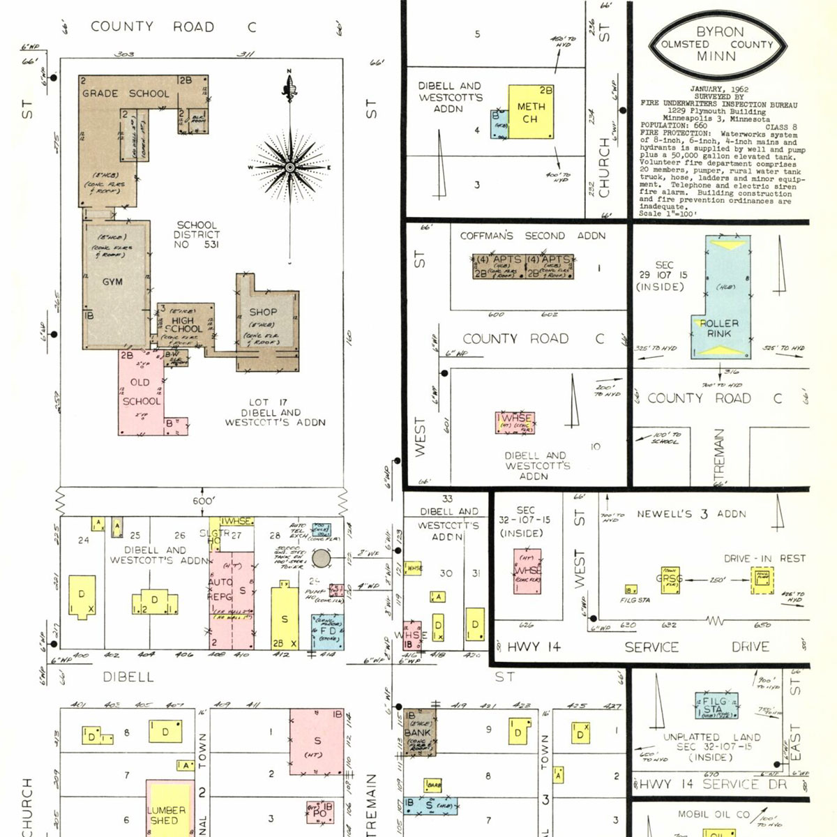
Fire insurance maps are highly detailed maps published in the 1800s and 1900s that show cities and other developed areas. Fire insurance maps include details such as:
- building occupants and property uses
- building size, construction materials and other structural details
- notations on heating systems, business equipment, chemical and petroleum product storage as well as firefighting measures
- location of roads, railroad tracks and shorelines.
Historic fire insurance maps are available in the FIM/Atlas layer of HistoryMosaic.
What is a Real Estate Atlas?
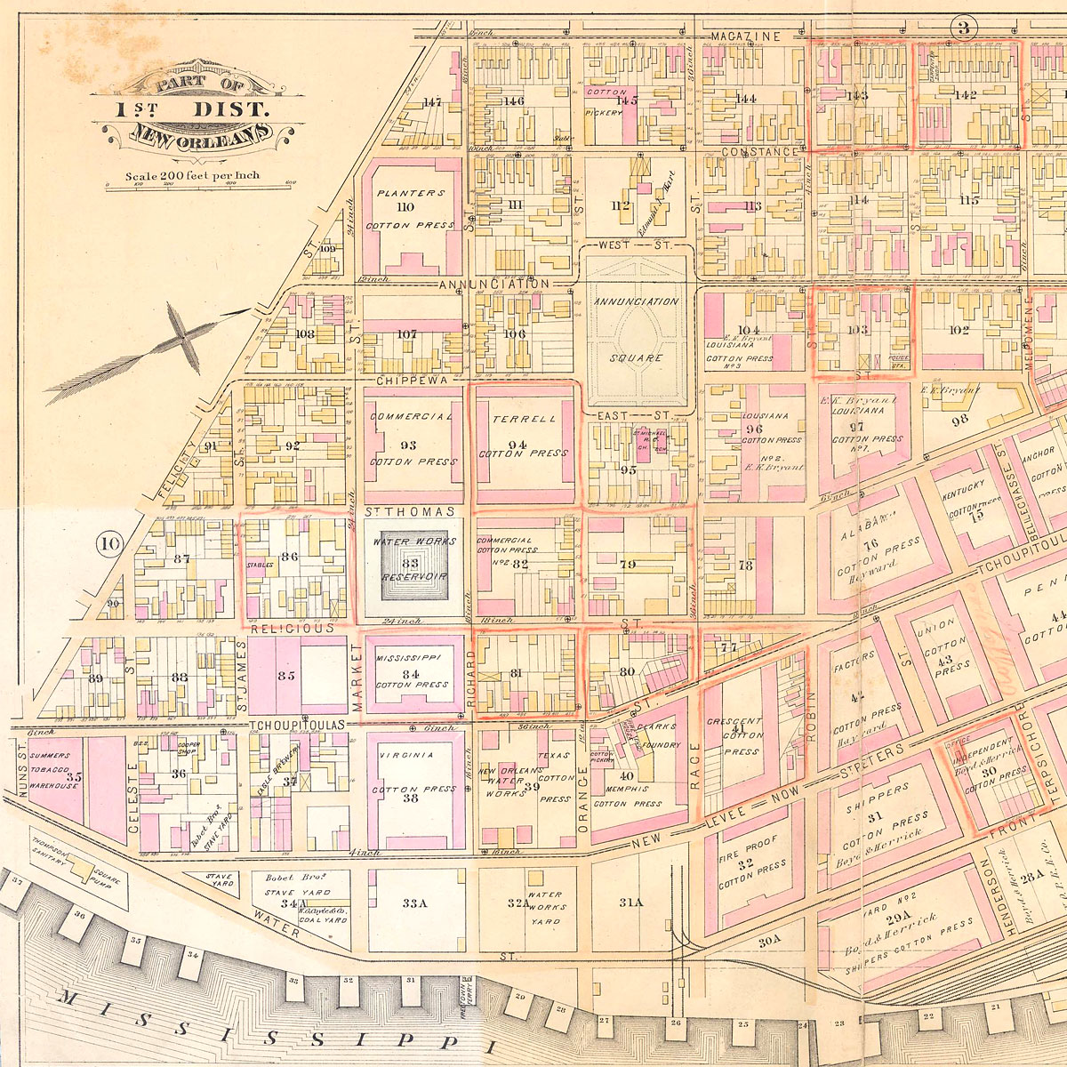
Historic real estate atlases depict roadways, property boundaries and property legal descriptions. Properties are often labeled with owner or occupant information. These maps typically include property boundary and structure dimensions.
From these historical maps you can see the footprints of old buildings and notes about structures that were present on properties in the past.
Changes to neighborhoods and homes can be observed by comparing maps of different dates. Real Estate Atlases are available in the FIM/Atlas layer of HistoryMosaic.
What is an Aerial Photograph?
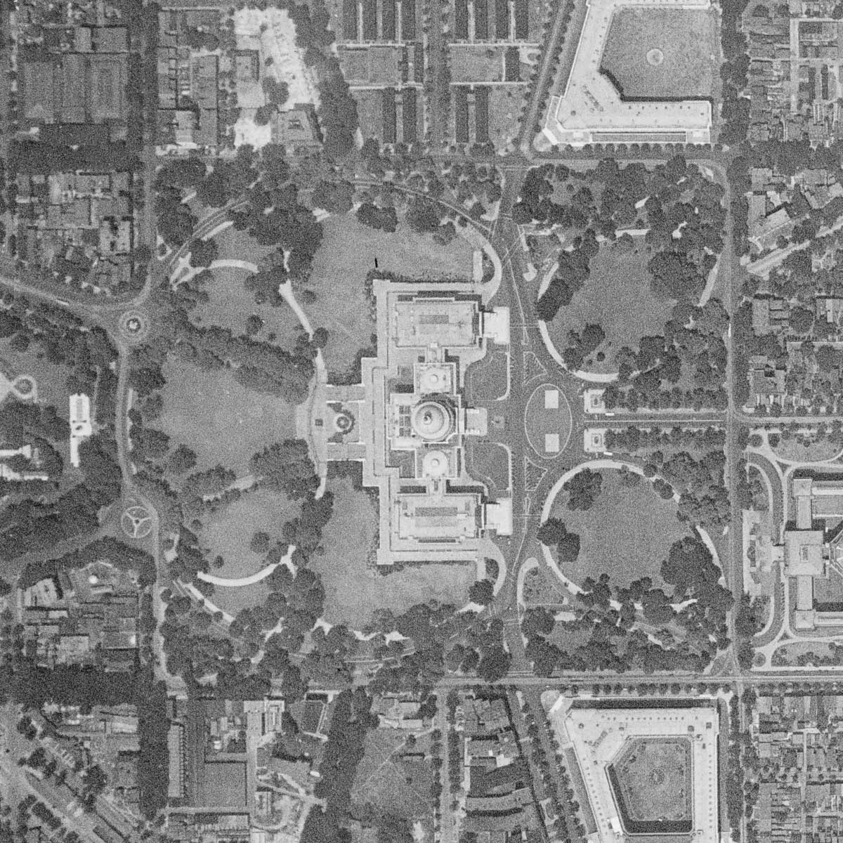
Much of the aerial photography available for the United States was contracted by government agencies which used them for a variety of purposes. These photographs are usually a straight-down view (vertical photography), although occasionally some photos were taken at an oblique angle. Aerial photographs were mostly created by using camera equipment installed in airplanes, though the earliest ones used balloons or kites to bring the camera aloft. Most of the aerial flights from the 1900s were shot on black and white film, with color and infrared film being much less common.
Modern aerial photography is done with digital cameras and is less expensive to produce than the old film methods. Color has become the dominant capture method and resolution tends to be higher than with film cameras.
Aerial photographs are available in the Aerial Frames layer and in the Aerial Flights layer of HistoryMosaic.
What is a Topographic Map?
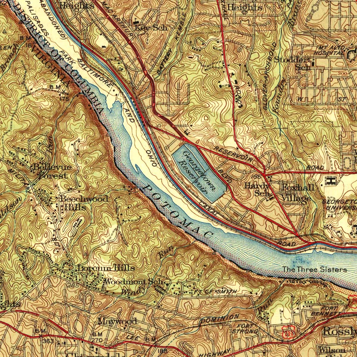
Topographic maps for the United States were first published in the 1800s and, over the years, maps have been created for the entire United States. Topographic maps show features such as:
- lakes, rivers and wetlands
-
topographic contour lines and color shading that indicates the primary land type or primary land use
- the footprint of cities and towns, and the location of individual buildings in rural areas
- railroad lines, roads, dams, bridges and other human-made features
- mines, ditches and other land disturbance activities
Most of the topographic maps in the HistoryMosaic collection were created by the U.S Geological Survey and other government agencies including the Army Map Service, Tennessee Valley Authority, Bureau of Land Management and others.
Topographic maps are available in the Topographic Maps layer of HistoryMosaic.
What are Street Directories?
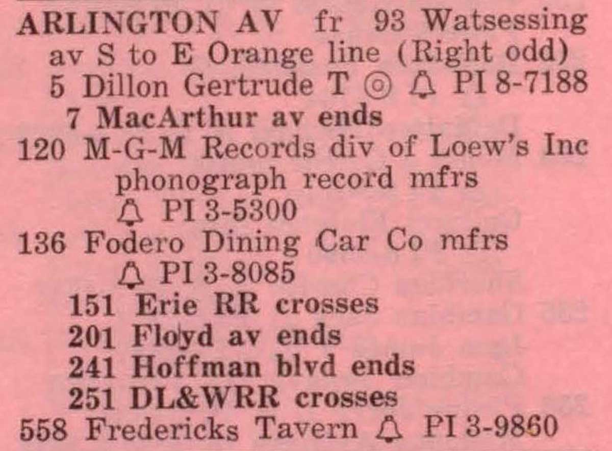
Street directories are listings of building occupants organized by street name, then building number address. Street directory listings are found in city directories, cross reference directories, street address telephone books and other publications. Some street directories include a description of the businesses, while the resident listings sometimes indicate the profession of the person or persons occupying the residence.
Street directories are available in the Street Directories layer of HistoryMosaic.
